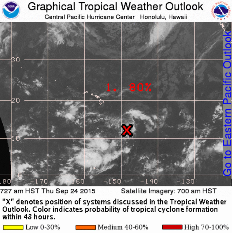
HAWAII: Tropical Disturbance 96-C has an 80% chance of developing into a tropical depression in the next two days, according to the National Weather Service. The area of low pressure has been lingering to the southeast of Hilo for days, but continues to drift towards the Hawaiian Islands and is expected to become better organized.

1. Showers and thunderstorms associated with an area of low pressure centered around 670 miles southeast of Hilo, Hawaii are gradually becoming better organized. Environmental conditions will remain conducive for development and a tropical depression may form as the system moves slowly toward the northwest.National Weather Service on Sept. 24, 2015 at 8 a.m. HST
On September 22, the Hawaii Emergency Management Agency issued a media release letting everyone know that they are keeping a close eye on TD 96-C. “Due to the close proximity to the state and high degree of uncertainty associated with TD 96-C,” the state said, “NWS will be tracking the storm very closely to provide the most up-to-date information to local emergency managers.”

“We are working in tandem with NWS to keep a close watch on TD 96-C and are coordinating closely with local emergency management and civil defense agencies to ensure they are prepared for any potential impacts the storm may bring to our state. The public should monitor media channels for the latest updates on storm development over the next several days.”Vern Miyagi, Administrator of Emergency Management on Sept. 22

by Big Island Video News9:23 am
on at
STORY SUMMARY
HAWAII ISLAND: Tropical Disturbance 96-C has an 80% chance of developing into a tropical depression in the next two days, according to the National Weather Service.