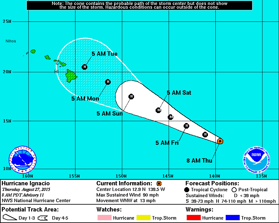
HAWAII ISLAND – The Hawaii County Civil Defense has issued the first audio message on the approaching Hurricane Ignacio, which is currently 1,135 east southeast of Hilo and on the verge of crossing over into the Central Pacific Basin.
“Currently, Ignacio has sustained winds of 90 miles per hour with higher gusts,” said the familiar voice of HCCD administrator Daryl Oliveira in the radio alert. “Hurricane force winds extend outwards from the center up to 25 miles and tropical storm force winds extend outward up to 60 miles. No watches or warnings are in effect at this time and the Civil Defense Agency continues to maintain close communication with the National Weather Service and is monitoring the system.”
The current forecast track is bringing Ignacio close to the Hawaiian Islands by early next week. “There is little change in the forecast philosophy since the previous advisory,” the National Weather Service reported at 5 a.m. HST this morning, “with the subtropical ridge north of Ignacio expected to steer the cyclone generally west-northwestward through the forecast period with a gradual decrease in forward speed.”

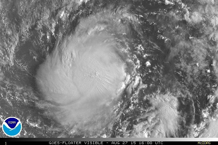
Hurricane Ignacio from the NOAA satellite
The National Weather Service continued:
“Some spread in the track guidance develops by day 5, as the ECMWF turns a weaker Ignacio westward while the GFS turns a stronger Ignacio northwestward. Despite this, the consensus models and the center of the guidance envelope are near the previous forecast, and the new forecast is a slightly faster update of the previous forecast.
Ignacio should remain over warm sea surface temperatures and in an environment of light vertical wind shear for at least the next two days, which should allow continued strengthening to a major hurricane. After that time, the cyclone should encounter increasing westerly shear and move over slightly cooler water, which should start a gradual weakening. The new intensity forecast follows this scenario and is basically unchanged since the previous advisory. One note of uncertainty in the intensity forecast is that the GFS shear at day 5, which is used in the SHIPS and LGEM models, looks weaker than that forecast by the ECMWF and UKMET models. Should the latter models verify, Ignacio could weaken faster than currently forecast.” – NWS discussion
Civil Defense is encouraging the community to take the time to prepare early for possible storm impacts that “could include high surf, strong winds, and heavy rains.”

by Big Island Video News6:40 am
on at
STORY SUMMARY
HAWAII ISLAND – The Hawaii County Civil Defense has issued the first audio message on the approaching Hurricane Ignacio, which is currently 1,135 east southeast of Hilo and on the verge of crossing over into the Central Pacific Basin. “Currently, Ignacio has sustained winds of 90 miles per hour with higher gusts,” said the familiar […]