UPDATE – 11:25 a.m.

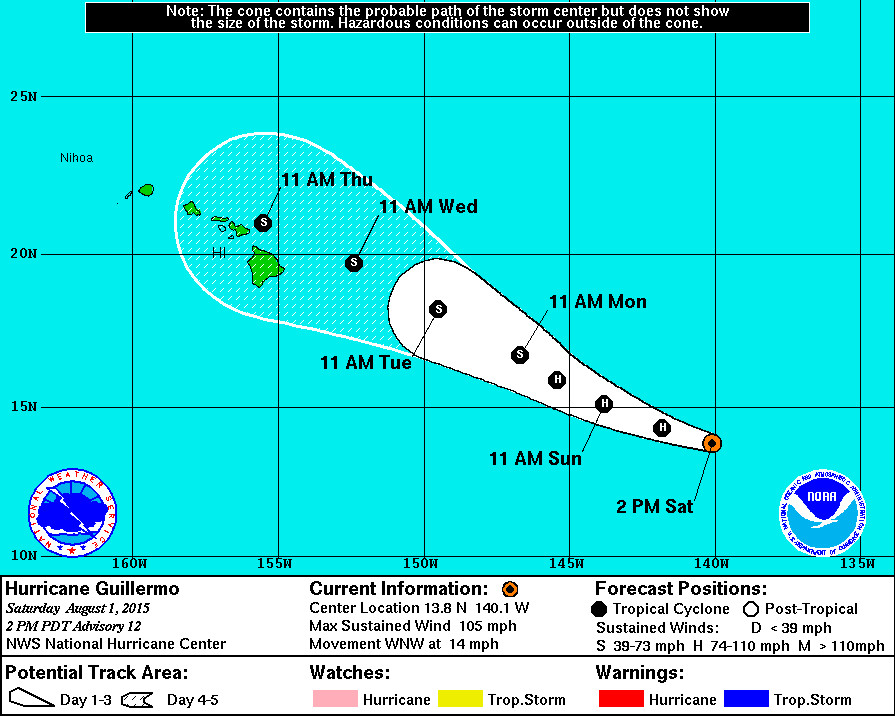
Coastal Watches/Warnings and 5-Day Forecast Cone for Storm Center, courtesy National Weather Service
- Hurricane Guillermo is 1,070 miles east southeast of Hilo and moving west northwest at 14 mph. A decrease in forward speed is expected. There are no coastal watches or warnings in effect. A
- Guillermo is a Category 2 hurricane. Maximum sustained winds remain near 105 mph with higher gusts. Guillermo should begin to gradually weaken tonight as it heads into a shear environment. The National Weather Service says the storm’s cloud pattern has begun to deteriorate.
- The multi-model consensus brings Guillermo just north or very near the Hawaiian Islands, but “due to uncertainties in longer-range track predictions,” the NWS says “it is important for users not to focus on the exact track forecasts at 96 and 120 hours.”
- Guillermo is now moving into the Central Pacific, so the Central Pacific Hurricane Center at Honolulu, Hawaii will provide the info and analysis from here.
UPDATE – 8:45 a.m.

Audio Player
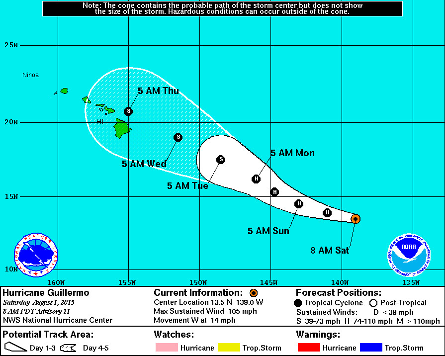
- Hurricane Guillermo is 1,140 miles east southeast of Hilo and moving west at 14 mph with little change in strength.
- Guillermo is a Category 2 hurricane with maximum sustained winds near 105 mph with higher gusts. Forecasters say the storm may have reached peak intensity, and little change in strength is expected today. A weakening trend is expected to begin on Sunday.
“By the time Guillermo approaches the Hawaiian Islands, the upper-level winds are forecast to be even more unfavorable, and by then, Guillermo is expected to have weakened to a tropical storm.” – National Weather Service
UPDATE – 12 a.m.

Audio Player
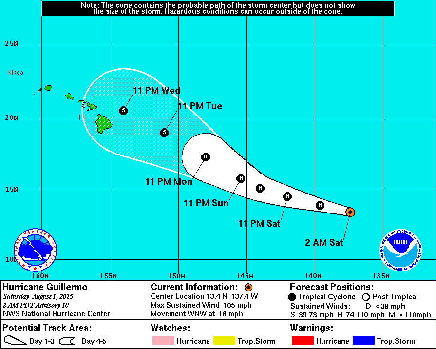
- Hurricane Guillermo is 1,250 miles east southeast of Hilo and moving west-northwestward at 16 mph with little change in strength.
- Guillermo is a Category 2 hurricane with maximum sustained winds near 105 mph with higher gusts. Forecasters say the storm may have reached peak intensity, and little change in strength is expected today and tonight. A weakening trend is expected to begin on Sunday.
- Long range tracking is tricky, according to forecasters. The National Weather Service discussed this in its 11 p.m. PDT update:
“In 3-5 days, the steering currents become less well defined in the global models and there is a fair amount of spread in the dynamical track predictions. The ECMWF model has been doing a bit of a flip-flop in its last few runs, and it has shifted back the south after shifting northward in the previous run. The official forecast is held very close to the previous NHC track and is close to the latest track model consensus, TVCN, which combines not only the GFS and ECMWF solutions but also the HWRF, GFDL, and U.K. Met. Office model forecasts.
Due to uncertainties in longer-range track predictions, it is important for users not to focus on the exact track forecasts at 96 and 120 hours.” – National Weather Service
We will be updating this page with the latest information on Hurricane Guillermo as it becomes available.

by Big Island Video News12:29 am
on at
STORY SUMMARY
We will be updating this page with the latest information on Hurricane Guillermo as it becomes available.