(ABOVE VIDEO) Footage from a Monday morning overflight – courtesy Ena Media Hawaii – cut with some audio from the media conference call with civil defense and USGS on the same day.
NEWS BRIEF
- New overflight video and new maps produced by USGS Hawaiian Volcano Observatory are providing a clearer understanding of upslope activity on the June 27 lava flow. Since lava emerged from the crack system on November 19, it has moved 1 mile downslope along the north and west margin of the original June 27th flow. The new lobe is 3.5 miles southwest of the transfer station on Apa`a St.
- Officials say the breakout does not pose an immediate threat to Kaohe Homesteads because the topography created by the June 27 lava flow when it first burned through the area is keeping the lava on its north side.
PRIMARY SOURCE

Scientists of the USGS Hawaiian Volcano Observatory (HVO) conducted an overflight of the June 27th lava flow earlier today. Breakouts remain active in and adjacent to the crack system near the abandoned geothermal well site. These breakouts are widening the flow field in this area, primarily to the north; the width in this area varies between about 250-350 m (275-380 yd). Since the breakouts from this part of the crack system started on November 19, the lava has moved 1.7 km (1 mi) downslope along the north and west margin of the original June 27th flow. This new lobe is 5.7 km (3.5 mi) southwest of the transfer station on Apa`a St. Smaller breakouts are also active about 3.5 and 5.3 km (2.2 and 3.3 mi) downslope of Puʻu ʻŌʻō . No significant changes were noted at Puʻu ʻŌʻō or the summit today.
The next overflight is scheduled for Friday.USGS Hawaiian Volcano Observatory on Nov. 24 at 5:41 p.m. HST
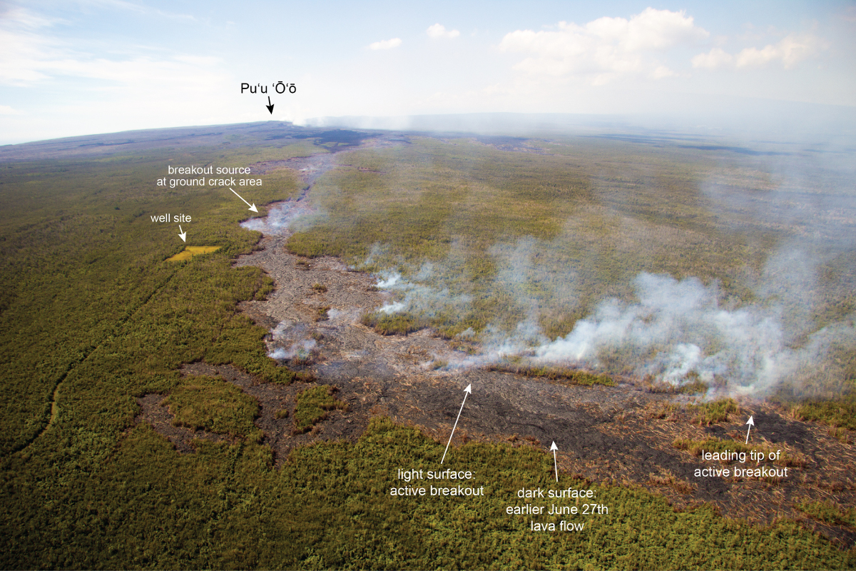
USGS photo labels the active breakout around the uplsope ground cracks and well site.
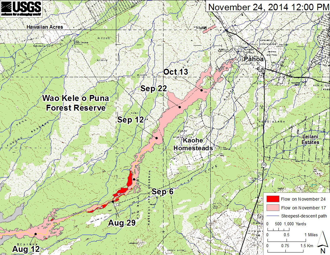
This large-scale USGS map shows the June 27th lava flow in Kīlauea’s East Rift Zone in relation to nearby Puna communities. The area of the flow on November 17, 2014, at 2:00 PM is shown in pink, while widening and advancement of the flow as mapped on November 24 at 12:00 PM is shown in red.
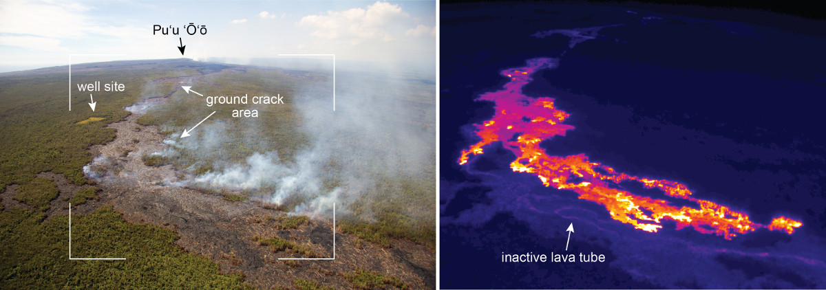
USGS HVO offers a comparison of a normal photograph with a thermal image of the breakout active in the area of ground cracks. The white box shows the rough extent of the thermal image. The thermal image shows the location of active pāhoehoe lobes scattered over the area of the breakout, with activity slowly advancing downslope towards the north (right side of images).

by Big Island Video News
on at
STORY SUMMARY
New overflight video and new maps are providing a clear understanding of upslope activity.