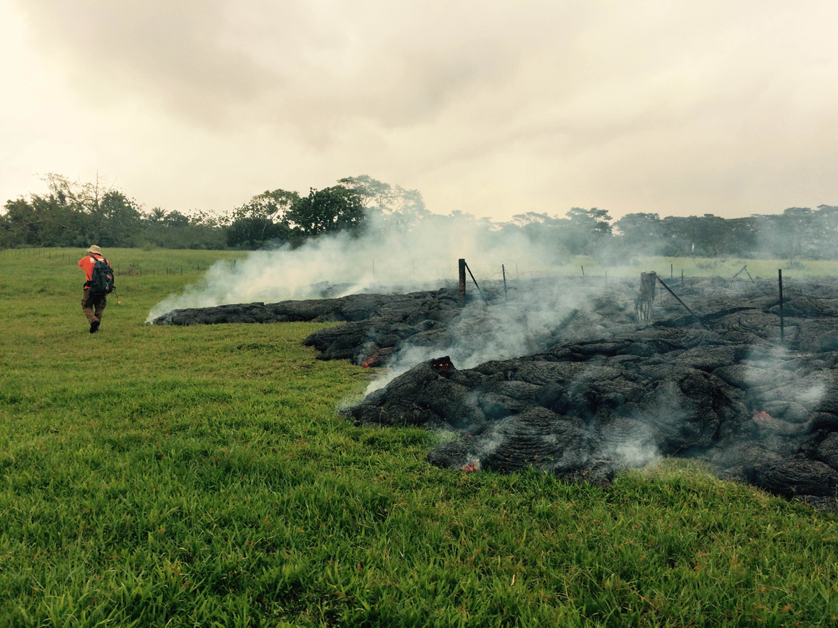
(ABOVE PHOTO) This photo was taken by the USGS Hawaiian Volcano Observatory on October 26. “As of 10 a.m. HST,” wrote HVO, “the June 27th flow front remains active and continues to advance towards the northeast. A portion of the front is still moving through the open field (shown here), while the leading tip of the flow has advanced through the Pāhoa cemetery.”
NEWS BRIEFS
- Between 5 p.m. yesterday to 9 a.m. today the lava flow went about 150 yards, and is advancing at a rate of 10 to 16 yards per hour.
- The flow front is about 330 yards past Apa’a Street in Pahoa, and has crossed through the cemetery. The lava is currently “coming out the lower end of the cemetery”, according to USGS scientist Tim Orr, who was on the ground to measure the flow earlier today.
- The flow front has almost split into two fingers. The leading finger is through the cemetery, but the lobe to the south is moving very slowly. Orr says the lobe has gone 50 meters in 24 hours.
- The HELCO pole surrounded by lava is still standing.
- The closest occupied home is about 300 yards away from the flow front.
- There are about 50 to 60 structures in the primary area, or direct path of the lava. Tuesday still looks like it will be evacuation day, but that time could be adjusted if the flow moves faster, Civil Defense admin Darryl Oliveira said during a conference call today.
INSIGHTS
Oliveira said the lava-inundated cemetery was an active, Buddhist cemetery. The local temple associated with the cemetery held a ceremony for the burial ground in anticipation of the lava flow. Oliveira said it was “very saddening to see the flow cross over and take out the gravesites.”
Below is a lengthy portion of today’s 11:30 a.m. HST media conference call with scientists from the USGS Hawaiian Volcano Observatory and Hawaii County officials.
PRIMARY SOURCES

HVO scientists monitored the leading portions of the June 27th flow on the ground yesterday. The narrow lobe that had been moving rapidly downslope reached Apaʻa St/Cemetery Rd near the driveway to the Pāhoa cemetery at 03:20 yesterday morning and finished crossing it at 03:50.
As of yesterday afternoon, this flow is the only area of the flow front that is advancing downslope. The rate of advance was varying between 10 and 15 m/hr (11-16 yd/hr) yesterday. The front moved 140 m (150 yd) from 5pm yesterday to 9am this morning, a rate of 9 m/hr. There appears to be an area of slightly steeper slope just below the cemetery and higher advance rates are possible if the flow reaches that point. The flow front was about 40 m (45 yd) wide at 5pm Saturday, but spread out in the relatively flat terrain near the cemetery and is roughly estimated to be (150 yd) wide presently.
The flow was deflected away from the steepest-descent line it had been generally following, and toward the cemetery, by an old man-made cane-field berm just above Apaʻa Street. The flow is now advancing downslope between two intersecting steepest-descent paths and will likely return to the original steepest-descent path about 300 m (330 yd) upslope from Pāhoa Village Rd (see map ).
Scientists are currently monitoring the flow front and will issue a status update this afternoon. USGS Hawaiian Volcano Observatory on Oct. 26 at 9:32 a.m. HST

An HVO geologist maps the margin of the June 27th lava flow in the open field below Apaʻa Street / Cemetery Road. This photo is courtesy USGS HVO.

by Big Island Video News1:12 pm
on at
STORY SUMMARY
The flow front is about 330 yards past Apa'a Street in Pahoa, and has crossed all the way through the cemetery.