EDITORIAL NOTE: After a visitor to our site questioned our previous headline, “VIDEO: Images Reveal Lava Breakout Becoming New Flow Front,” we have taken the criticism under consideration and changed the headline. While new maps published by USGS specifically attach the label “Sept 24 flow front” to the breakout, we agree that the previous headline could be seen as a forward looking statement.
(ABOVE PHOTO) A look at the stalled June 27 lava flow front and the breakout that is slowly advancing to the northeast, from Ena Media Hawaii / Courtesy of: Blue Hawaiian Helicopters
(ABOVE VIDEO) Hawaii County Civil Defense message for Wednesday, September 24, with video from Ena Media Hawaii / Courtesy of: Blue Hawaiian Helicopters as well as USGS Hawaiian Volcano Observatory maps and video depicting a geologist sampling lava on the June 27th lava flow using a rock hammer. USGS says “lava samples like this are routinely collected for chemical analysis, which provides insight into the magmatic system feeding the eruption.”
NEWS BRIEFS
- New images from Ena Media Hawaii aboard Blue Hawaiian Helicopters and from the USGS Hawaiian Volcano Observatory provide a good illustration of the stalled flow front and its relationship to a new, slow moving breakout that is advancing to the northeast.
- USGS also issued a few new maps of the June 27 lava flow.
PRIMARY SOURCES
These photos come to us via Ena Media Hawaii on a Wednesday lava flow overflight courtesy Blue Hawaiian Helicopters.
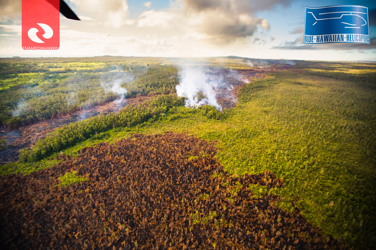
Photo of the June 27 lava flow taken on Sept. 24, 2014 by Ena Media Hawaii / Courtesy of: Blue Hawaiian Helicopters
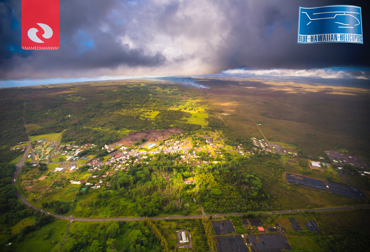
Photo of the June 27 lava flow taken on Sept. 24, 2014 by Ena Media Hawaii / Courtesy of: Blue Hawaiian Helicopters

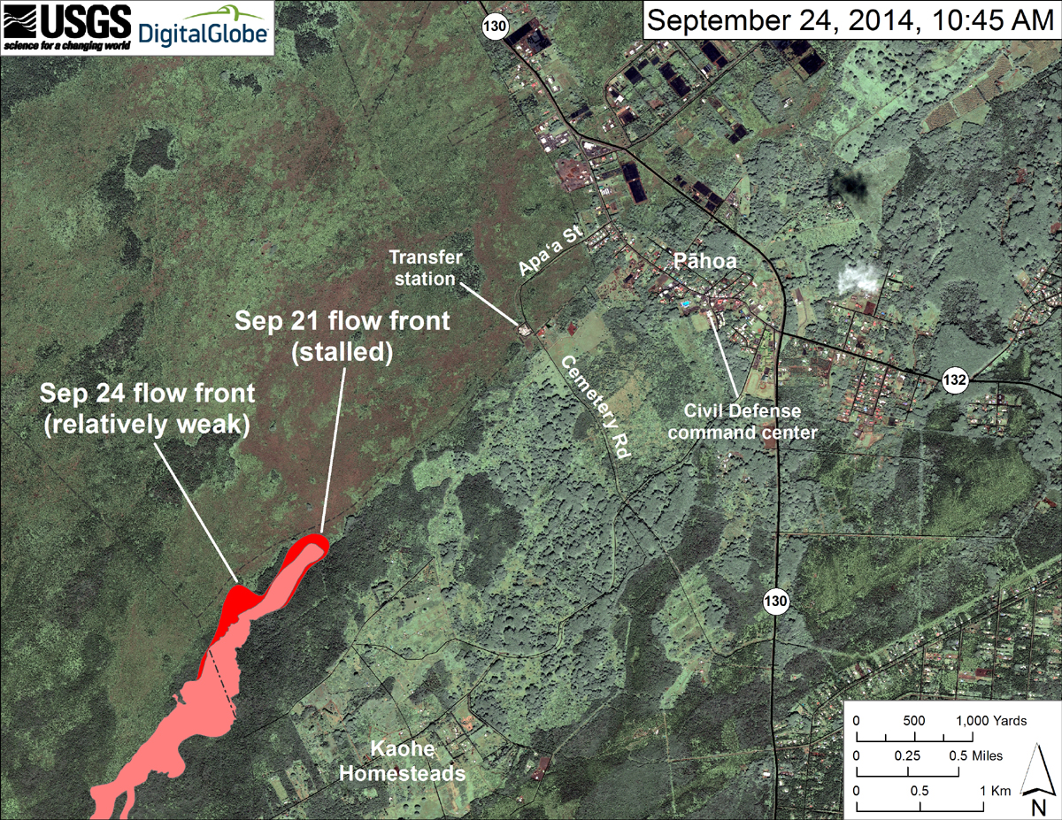
According to USGS HVO, “This map uses satellite imagery acquired in March 2014 (provided by Digital Globe) as a base image to show the area around the front of the June 27th lava flow. The flow front closest to the transfer station was inactive, but small, sluggish breakouts were scattered across the surface of the flow upslope from the stalled front. The most active breakout was advancing northeast from the north margin of the flow. Because the flow has not been advancing at its leading edge, we do not project its advance at this time.”
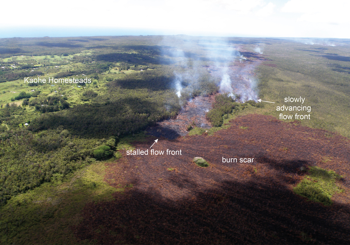
USGS posted this photo on September 24, saying, “The leading edge of the June 27th flow stalled over the weekend, but active breakouts persist near the flow front, a short distance behind this stalled front. Today, lava was slowly advancing on a different front, along the north margin of the flow. The burn scar from a brush fire triggered by the lava this weekend covers much of the lower portion of the photograph.”
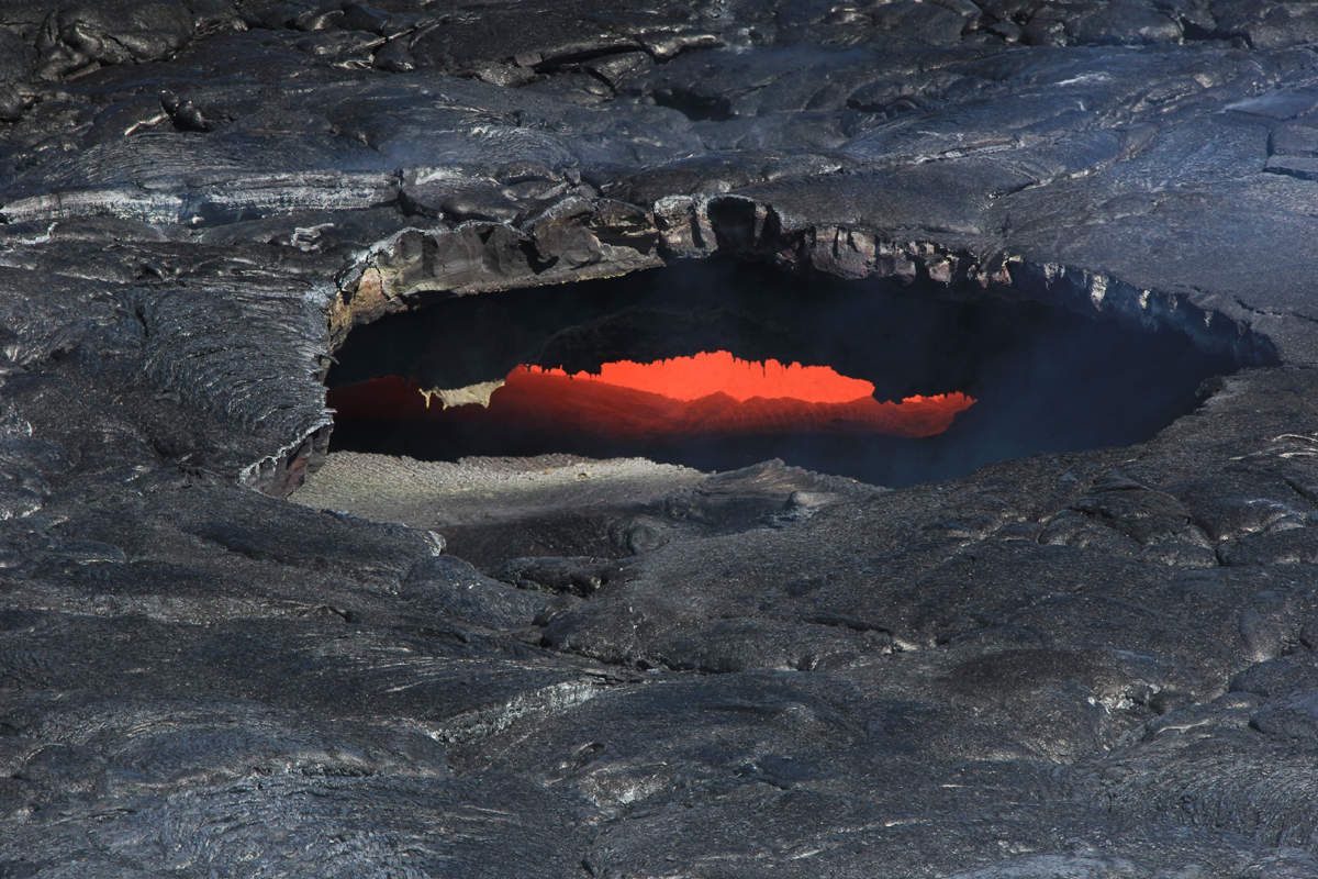
USGS reports several skylights “provided views into the June 27th lava tube today, and the fluid lava stream could be seen moving downslope.”

by Big Island Video News
on at
STORY SUMMARY
New images show the stalled flow front and its relationship to the slow moving breakout advancing northeast.