(ABOVE VIDEO) Hawaii County Civil Defense message with USGS video, maps, and photos, as well as video from other sources
NEWS BRIEFS
- The lava continues to head northeast and has advanced about 100 yards since yesterday.
- The leading edge or front of the flow is approximately 150 yards wide.
- No evacuations have been ordered.
SOURCES

This morning’s assessment shows the surface lava flow continues towards the northeast and has advanced approximately 100 yards since yesterday. The active edge of the surface flow had exited the northwest corner of the Kaohe Homesteads and has moved from the forested area to open land with lighter vegetation. The leading edge or front of the flow is approximately 150 yards wide. Currently the flow does not pose an immediate threat to area communities and area residents will be given adequate notice to safely evacuate should that be necessary.
There is no brushfire threat at this time and all burning is limited to the vegetation that is in direct contact with the flow. Smoke conditions in the area was light to moderate and expected to improve with the increase in morning winds.
Construction activities on the Railroad Avenue and Government Beach Road are continuing.
Once again, the public is reminded that the flow cannot be accessed and is not visible from any public areas. Access to the Kaohe Homesteads subdivision remains restricted and limited to subdivision residents only. Hawaii County Civil Defense on Sept. 20, 2014
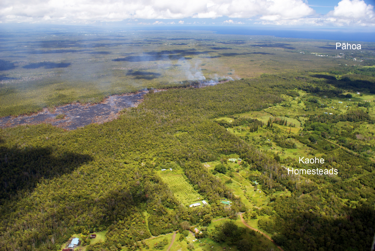
USGS HVO captures the view of the flow front, looking north. Pāhoa is located in the upper right portion of the photograph. The flow front today was 3.4 km (2.1 miles) from Pāhoa Village Road.
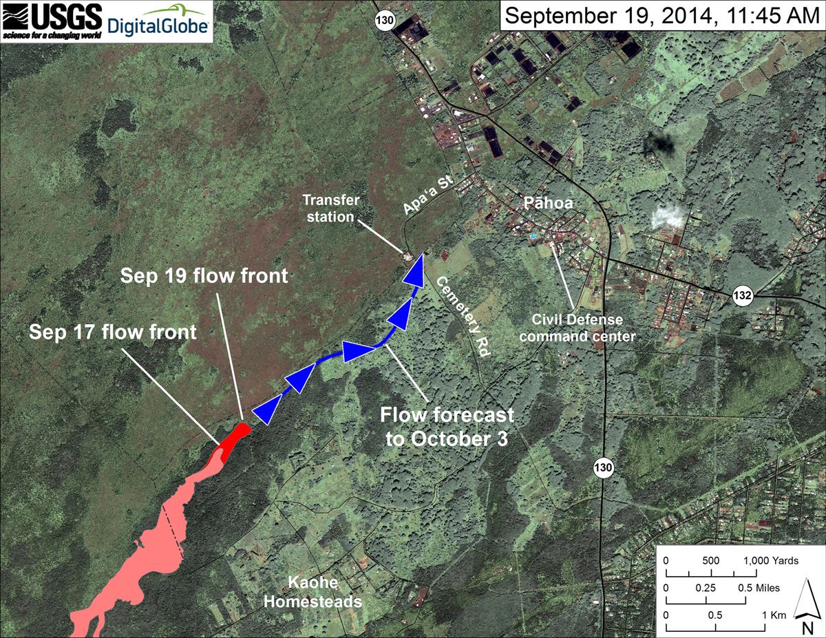
USGS HVO: “This map uses satellite imagery acquired in March 2014 as a base image to show the area around the front of the June 27th lava flow. The blue line and arrowheads show the projected path of the flow over the next two weeks (to October 3), based on the average flow rate over the last two days and the local topography. Lava flow behavior is complex and this projection is subject to change. Satellite image provided by Digital Globe.”

by Big Island Video News
on at
STORY SUMMARY
The lava continues to head northeast and has advanced about 100 yards since yesterday.