(ABOVE VIDEO) The Hawaii County Civil Defense message issued Friday morning with video from various sources filmed over the last few days.
PUNA, Hawaii – The flow front has moved beyond Kaohe Homesteads and into open land, as it continues its northeatern march towards Pahoa.
In its morning eruption information update, Civil Defense notes the vog present from Puna all the way north into parts of Hilo is due to emissions from Pu’u o’o, and should get better later in the day as trade winds increase.

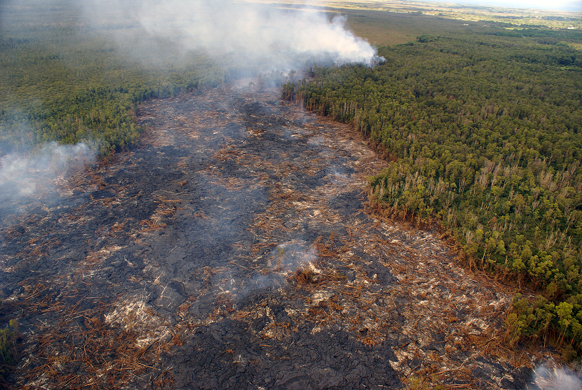
This morning’s assessment shows the surface lava flow continues towards the northeast and has advanced approximately 180 yards since yesterday. The active edge of the surface flow has exited the northwest corner of the Kaohe Homesteads and has moved from a forested area to open land with lighter vegetation. The leading edge or front of the flow is approximately 100 yards wide. Currently the flow does not pose an immediate threat to area communities and area residents will be given adequate notice to safely evacuate should that be necessary.
There is no brushfire threat at this time and all burning is limited to the vegetation that is in direct contact with the flow. Smoke conditions were light to moderate at the flow, however heavy vog from the Pu’u O’o vent was present this morning over the lower Puna areas and extending into Keaau and parts of Hilo. Conditions are expected to improve as the trade winds pick up later today.
Construction activities on the Railroad Avenue and Government Beach Road are continuing. These activities are to establish alternate road access in the event Highway 130 is affected by the lava flow.
The public is reminded that the flow cannot be accessed and is not visible from any public areas. Access to the Kaohe Homesteads subdivision will remain restricted and limited to subdivision residents only. Everyone’s cooperation and assistance is greatly appreciated. Hawaii County Civil Defense on Sept. 19, 2014
The USGS Hawaiian Volcano Observatory also issued their Kilauea Status update on Friday morning at 9:27 a.m.

A Civil Defense overflight this morning observed that the flow continues heading in a northeast direction in the northwest portion of Kaohe Homesteads. The flow front reached the boundary of thick forest and is now on more open ground. The flow front had advanced at an average rate of roughly 200 m/day (660 ft/day) between Sep 17 and 19, which is lower than the advance rate of 290 m/day (960 ft/day) between Sep 15 and 17. Fluctuations in flow advance rate like this are common for pahoehoe lava flows. The flow front was 16.3 km (10.1 miles) from the vent, measured in a straight line. The actual length of the flow, measured along the lava tube axis (so that bends in the flow are considered) was 18.6 km (11.6 miles). The flow front yesterday afternoon was 2.4 km (1.5 miles) upslope from Apa`a St. Active portions of the flow are still in thick forest, creating smoke plumes as lava engulfs trees and other vegetation, but fires are not spreading away from the flow.USGS Hawaiian Volcano Observatory on Sept. 19, 2014

A view looking down the axis of the flow at the flow front, courtesy USGS Hawaiian Volcano Observatory. Pāhoa is in the upper right portion of the photograph.

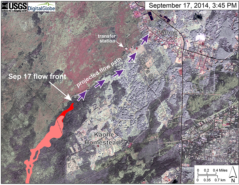
USGS HVO: “This map uses a satellite image acquired in March 2014 as a base image to show the area around the front of the June 27th lava flow. The purple arrows show the projected path of the flow over the coming two weeks, based on the current flow activity and local topography. Lava flow behavior is complex and this projection is subject to change. Satellite image provided by Digital Globe. “

by Big Island Video News10:16 am
on at
STORY SUMMARY
Hawaii County Civil Defense says the active surface flow front has exited Kaohe Homesteads.