(ABOVE VIDEO) Raw video by Mick Kalber filmed during a Wednesday evening flyover with Paradise Helicopters.
Video by Mick Kalber
PUNA, Hawaii – The Volcano Alert Level remains at a Warning status, as the June 27 lava flow continues its advance towards Pahoa.
The USGS Hawaiian Volcano Observatory issued this Volcanic Activity Notice on Wednesday evening:

Between September 15 and 17, the June 27th flow narrowed and advanced northeastward at an average rate of 290 m/day (960 ft/day). By the afternoon of September 17, the flow had advanced approximately 16 km (10 mi) straight-line distance from the vent into the vacant, forested northwest portion of Kaohe Homesteads. At the average rate of advancement of 290 m/day (960 ft/day) since September 15, we project that lava could flow from its current location to Apa`a Rd in 9 days and to the Pāhoa Village Road (government road) in Pāhoa within 13 days. These estimates will be updated after our next overflight scheduled for Friday. USGS Hawaiian Volcano Observatory
Video captured by Mick Kalber, once again flying with Paradise Helicopters, shows the lava flow burning its way through trees, as it nears the edge of the forest.
These maps were also released by USGS:
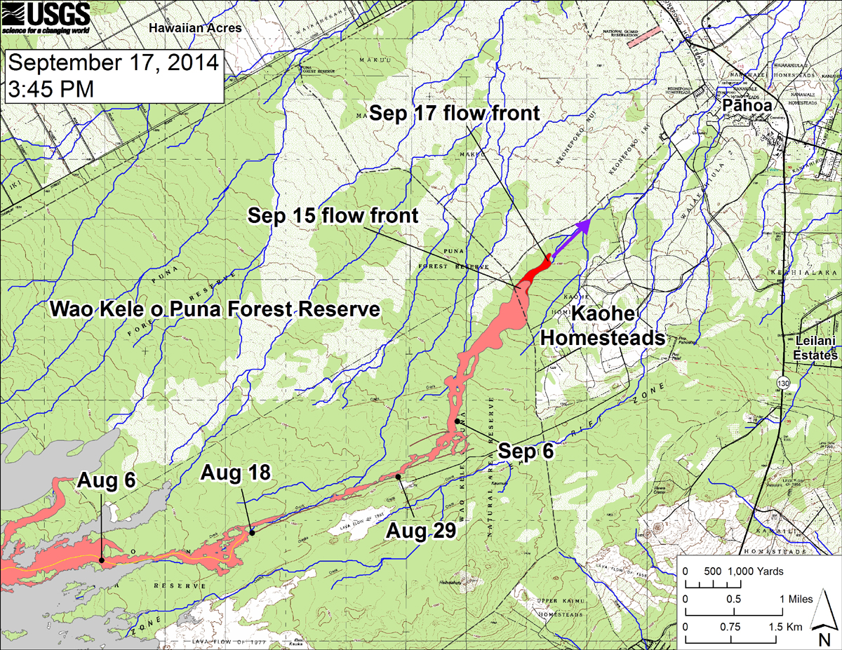
USGS HVO: “This large-scale map shows the distal part of the June 27th flow in relation to nearby Puna communities. The black dots mark the flow front on specific dates. The latitude and longitude of the flow front on September 17 was 19.4737016 /-154.977834 (Decimal degrees; WGS84). The blue lines show down-slope paths calculated from a 1983 digital elevation model (DEM; for calculation details, see http://pubs.usgs.gov/of/2007/1264/). Down-slope path analysis is based on the assumption that the digital elevation model (DEM) perfectly represents the earth’s surface. But, DEMs are not perfect, so the blue lines on this map indicate approximate flow path directions. The purple arrow shows a short term projection of flow direction based on the flow behavior over the past several days and the local topography.”
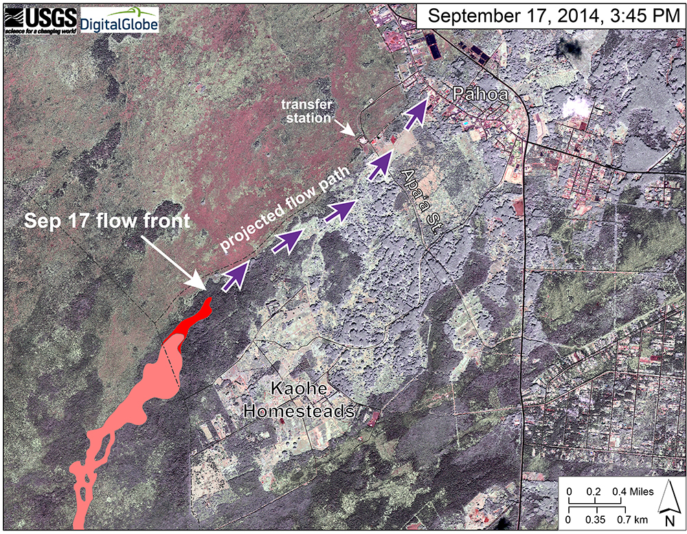
USGS HVO: “This map uses a satellite image acquired in March 2014 as a base image to show the area around the front of the June 27th lava flow. The purple arrows show the projected path of the flow over the coming two weeks, based on the current flow activity and local topography. Lava flow behavior is complex and this projection is subject to change. Satellite image provided by Digital Globe. “

by Big Island Video News
on at
STORY SUMMARY
New overflight video shows the lava flow burning its way through trees, as it nears the edge of the forest.