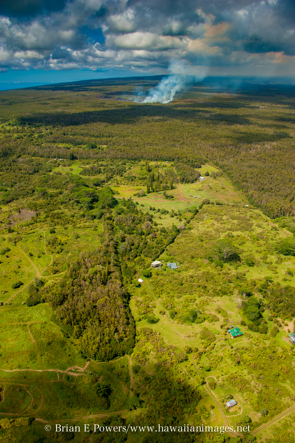
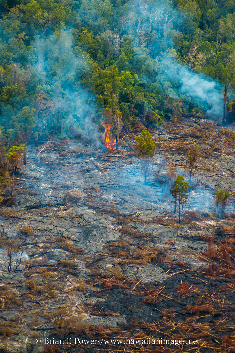
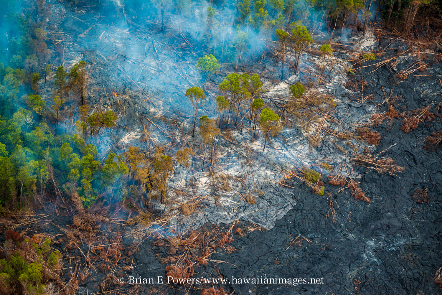
(ABOVE VIDEO) Monday morning’s Civil Defense message accompanied by photos from a Saturday overflight taken by Brian E. Powers of Hawaiian Images Photography and Video. You can find more on his website: hawaiianimages.net.
PUNA, Hawaii – The June 27 lava flow remains active in the Wao Kele o Puna Forest Reserve. There seems to be a slight divergence in its reported direction according to public information statements posted on Monday morning by the two authorities monitoring the lava flow. Hawaii County Civil Defense reports the flow is moving very slowly in a north direction, parallel to the forest reserve boundary. Kaohe Homesteads is on the other side of that boundary. Meanwhile, the USGS Hawaiian Volcano Observatory wrote in its Monday morning update that the flow is continuing to move northeast from the ground crack, citing a Civil Defense overflight this morning.
Before we get to the full text from the updates provided by Civil Defense and USGS, we want to share some stunning photos taken by Brian Powers of Hawaiian Images Photography and Video. He took a flight over the East Rift Zone on Sunday and shared these images.

(Courtesy Brian Powers, http://www.hawaiianimages.net ) Photo shows the proximity of the lava flow to Kaohe Homesteads near Pahoa.

(Courtesy Brian Powers, http://www.hawaiianimages.net ) An ohia tree bursts into flames at the front of the June 27 lava flow on Sunday.

(Courtesy Brian Powers, http://www.hawaiianimages.net ) Powers captured these images during a solo overflight by “pulling a tight circle with one hand on the stick and the other on my camera.”

This morning’s assessment shows the surface lava flow continues very slowly in a north direction. Very little vegetation is burning and there is no wildfire threat at this time. Weather and fire conditions are being monitored closely. The surface flow has advanced approximately 150 yards since yesterday. Subsurface flow activity also continues. The surface flow is moving very slowly and does not pose an immediate threat to area residents. The surface flow is located approximately .8 miles southwest or upslope of the Wao Kele Puna Forest Reserve boundary and moving in a north direction and parallel to the forest reserve boundary.
Presently, the current activities and flow does not present with an immediate or imminent threat to area communities. No evacuation is required at this time. Eruption activity will continue to be monitored and additional updates will be provided.
Although the current flow activity does not pose an immediate threat to area communities, residents are encouraged to continue to review their emergency plans in the event conditions change and should an evacuation be necessary.
The public is reminded that the flow cannot be accessed and is not visible from any public areas. Access to the Kaohe Homesteads subdivision will be restricted and limited to subdivision residents only.Hawaii County Civil Defense message, Sept. 8, 2014

The June 27th lava flow remains active. A Civil Defense overflight yesterday morning observed continued slow advancement of the flow front towards the northeast, away from the ground crack from which it issued. A Civil Defense overflight this morning also observed flows continuing to move northeast from the ground crack, with the flow front having advanced several hundred meters (yards) since it was mapped on Saturday morning. The front of the active flows as mapped on Saturday morning was 13.2 km (8.2 miles) from the vent and 1.4 km (0.9 miles) from the eastern boundary of the Wao Kele o Puna forest reserve. The flow front remains in thick forest, creating smoke plumes.
Small breakouts also remain active closer to Puʻu ʻŌʻō, roughly midway along the length of the June 27th flow. None of these breakouts have been very vigorous recently. Some of these breakouts are also creeping into the forest and producing smoke plumes.USGS Hawaiian Volcano Observatory update, Sept. 8, 2014

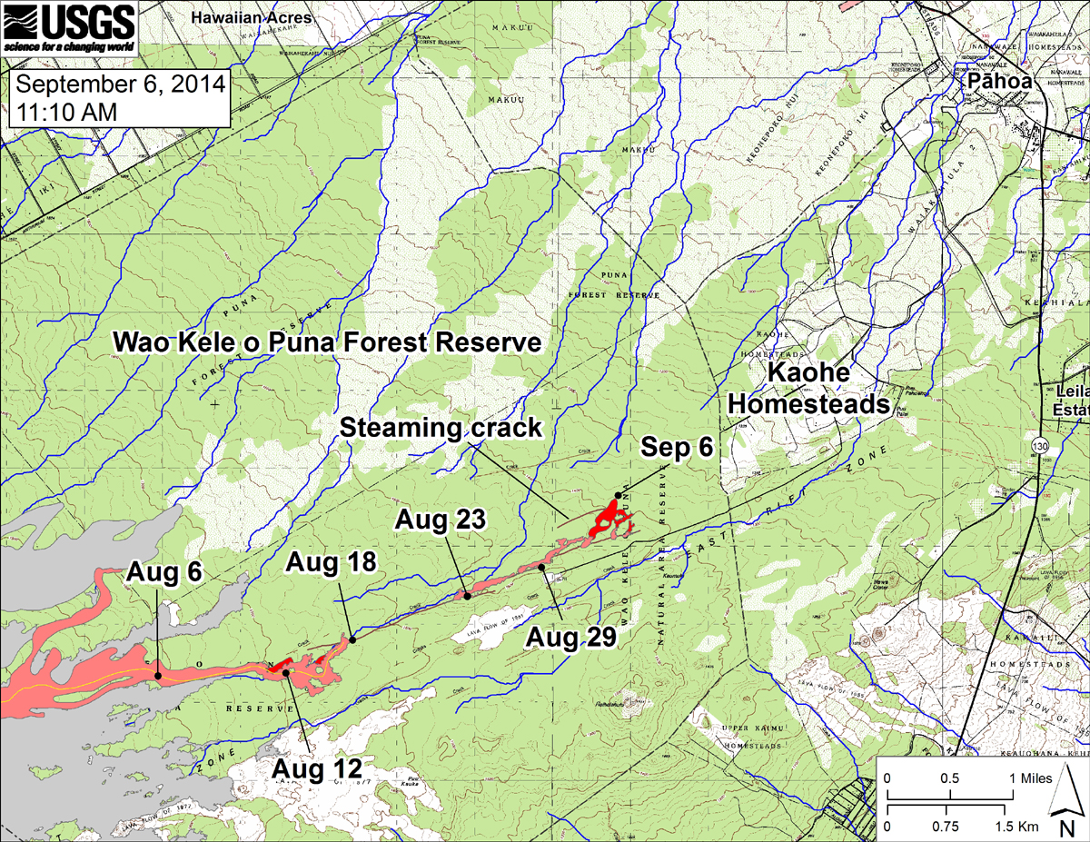
USGS HVO says, “This large-scale map shows the distal part of the June 27th flow in relation to nearby Puna communities. The area of the flow on September 3 is shown in pink, while widening and advancement of the flow as mapped on September 6 at ~11:10 AM is shown in red. The black dots mark the flow front on specific dates. September 6 point Lat/Lon position: 19.448003/-154.992676 Decimal Degrees; WGS84. The blue lines show down-slope paths calculated from a 1983 digital elevation model (DEM; for calculation details, see http://pubs.usgs.gov/of/2007/1264/).”

by Big Island Video News9:55 am
on at
STORY SUMMARY
The June 27 lava flow remains active in the Wao Kele o Puna Forest Reserve.