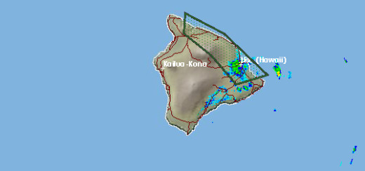
HILO, Hawaii – A Flash Flood Warning has again been issued for the already-drenched Island of Hawaii. According to the National Weather Service, the radar showed heavy rain falling over the Big Island windward slopes, “with a thunderstorm over Hilo producing rainfall in excess of 2 inches per hour on saturated ground”.
The warning – as the NWS map above indicates – stretches the entire Hamakua Coast and is in effect until 8:15 p.m. HST.
The island barely recovered from a severe soaking earlier today/last night that forced road closures, created massive ponding on roads, and even opened a sinkhole in Paauilo mauka that swallowed a car.
This video was taken by Out of the Sea Media overlooking Umauma Stream. The river is swollen with all the precipitation.
Social media was full of images and video of the deluge.

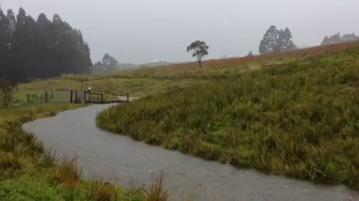
Laupahoehoe resident Judi Steinman shared some images of her goat pasture, which she says is normally dry.
Meanwhile, the rumbling of thunder overhead continues.
How long will this rain last? Earlier today, the National Weather Service said they expected conditions to improve today, but now that Monday is almost over and a flash flood warning has returned, the NWS is saying this on its website:
There are concerns over the stationary nature of the storm over the island. The longer the system sits over Hawaii the more rain we are likely to see. The video below illustrates the flooding earlier in the day in Hilo, as storm run-off ditches were filled to capacity.


by Big Island Video News6:14 pm
on at
STORY SUMMARY
HILO, Hawaii – A Flash Flood Warning has again been issued for the already-drenched Island of Hawaii. According to the National Weather Service, the radar showed heavy rain falling over the Big Island windward slopes, “with a thunderstorm over Hilo producing rainfall in excess of 2 inches per hour on saturated ground”. The warning – […]