HILO, Hawaii: Noise from Hilo International Airport was the subject of a meeting held on Wednesday night.
The State Department of Transportation held a public informational session to present the Hilo International Airport Noise Exposure Maps Update.
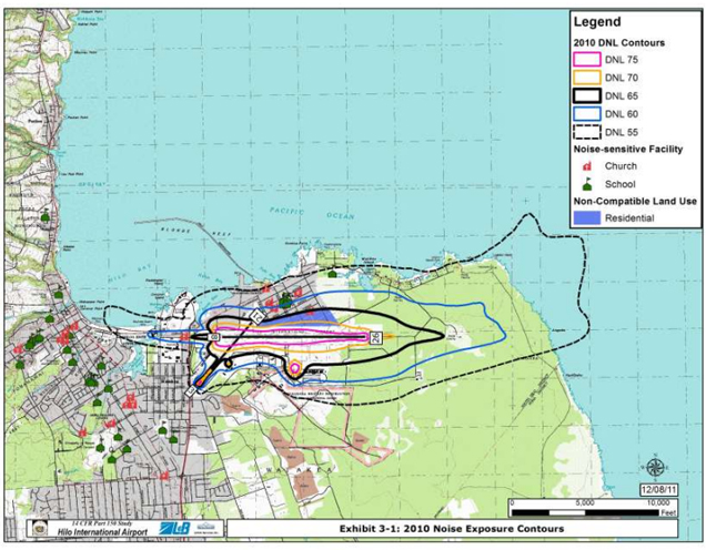
The DOT says the study updates the Noise Exposure Maps that are used to evaluate land-use compatibility with the Hilo International Airport.
The results of the study were explained to the public – mostly residents of Keaukaha who essentially live right under the airport.
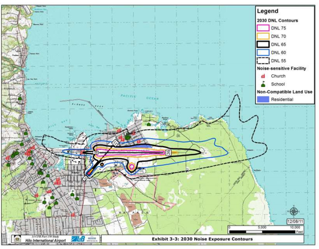
According to the study’s consultant, although air traffic at the airport will increase over the next few decades, the noise level is expected to decrease slightly.
Of course, the residents who live with the noise had plenty of questions for the officials.
To review the draft report, you can visit the Hilo International Airport website at hawaii.gov/ito.
The following two images show the noise exposure contours surrounding the airport for areas like Keaukaha. The second is a projection for 2030.


by Big Island Video News8:15 am
on at
STORY SUMMARY
HILO, Hawaii: Noise from Hilo International Airport was the subject of a meeting held on Wednesday night. The State Department of Transportation held a public informational session to present the Hilo International Airport Noise Exposure Maps Update. The DOT says the study updates the Noise Exposure Maps that are used to evaluate land-use compatibility with […]