 Media release | USGS Hawaiian Volcano Observatory
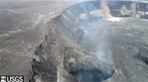
About the video: This Quicktime movie shows a quick video of the lava lake in Halema`uma`u crater taken during today’s overflight. The lava surface has recently been very shallow, as little as 90 meters (98 yards) below the floor of Halema`uma`u crater. When the video was taken, the lava was at a high stand during part of a rise and fall cycle, when very little gas is emitted and views are clear. About seven minutes after the video was taken, violent spattering and gas release occurred from the lake margin, triggering a drop of the lava surface to a low-stand level. The substantial overhang along the north rim of the vent cavity is shown very well by the video. Additionally, the remains of the partially destroyed Halema`uma`u Overlook—on the rim of Halema`uma`u crater, directly above the vent cavity—can be seen several times during the clip. For scale, the vent cavity is about 150 meters (164 yards) wide.
From the HVO Kilauea Status Page (http://volcanoes.usgs.gov/hvo/activity/kilaueastatus.php):
Past 24 hours at Kilauea summit: The lava lake level rose slightly to an overnight high point estimated at 77 m (250 ft) below Halema`uma`u Crater floor at the top of back-to-back high lava stands. Since early 2010, glow has been strong from the Jaggar Museum Overlook and many other Kilauea Crater rim locations overnight when lava was at background levels; paradoxically, weaker glow prevailed while lava was at its highest level. Seismic tremor levels were elevated, dropping to low levels during high lava stands followed by a strong seismic tremor burst as lava drains back to its previous level; tremor levels in-between high stands remained steady at nearly double the amplitude of tremor on February 7.
The summit tiltmeter network recorded continued inflation with brief deflation accompanying the longer high lava stands. The network of GPS receivers recorded continued extension across the summit since the beginning of November, the most recent part of a long-term extension across the summit crater since early 2010 which was focused near Halema`uma`u Crater vent.
Seventeen earthquakes were strong enough to be located within Kilauea volcano – seven were located within the upper east rift zone, three beneath the summit caldera, and seven on south flank faults; the ongoing seismicity within the upper east rift zone seemed to peak around the magnitude-3.8 quake Thursday morning but we will continue to watch this area closely.
The summit gas plume was wispy, almost invisible, and rising vertically. The most recent (preliminary) sulfur dioxide emission rate measurement was 400 tonnes/day on February 8, 2011 averaged over at least one high lava stand during which the emissions may be halved; new measurements must await the return of moderate trade winds. In addition to gas, the plume wafted small amounts of ash-sized tephra, mostly fresh spatter, that were deposited on nearby downwind surfaces.

by Big Island Video News8:34 pm
on at
STORY SUMMARY
Media release | USGS Hawaiian Volcano Observatory About the video: This Quicktime movie shows a quick video of the lava lake in Halema`uma`u crater taken during today’s overflight. The lava surface has recently been very shallow, as little as 90 meters (98 yards) below the floor of Halema`uma`u crater. When the video was taken, the […]