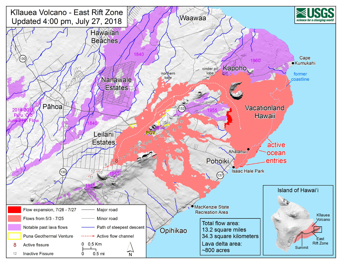
(USGS) Map as of 4:00 p.m. HST, July 27, 2018. Given the dynamic nature of Kīlauea’s lower East Rift Zone eruption, with changing vent locations, fissures starting and stopping, and varying rates of lava effusion, map details shown here are accurate as of the date/time noted. Shaded purple areas indicate lava flows erupted in 1840, 1955, 1960, and 2014-2015.
(BIVN) – Another surge in lava output appears to be occurring at Fissure 8 on the lower East Rift Zone of Kilauea Volcano, following another summit collapse event this morning.
The USGS Hawaiian Volcano Observatory says the collapse event occurred this morning at 2:37 a.m. HST. and was equivalent to a Magnitude 5.4, according to the Pacific Tsunami Warning Center.
“HVO field crew report fluctuations in the channel level with spillovers occurring in the upper portion of the channel this morning,” a 6 a.m. civil defense message stated.
As of yesterday’s overflight, the eastern margin of the flow near Pohoiki has not advanced southward and remains approximately 500 feet from the Pohoiki Boat Ramp at Isaac Hale Park, officials say. The surge in lava along the Fissure 8 channel may or may not change the situation downslope and observers will be watching it closely.
State Highways reports no new cracks on Highway 11, but request motorists between mile marker 28 and 32 stay on the pavement and be alert for changes in roadway conditions, civil defense says.
The Disaster Recovery Center, located at the Kea`au High School Gym is moving to the Pahoa Community Center beginning Monday, July 30. Hours of operations is 8 AM to 6 PM weekdays and 8 AM to 4 PM on Saturdays.

by Big Island Video News
on at
STORY SUMMARY
HAWAII ISLAND - field crew report fluctuations in the channel level with spillovers occurring in the upper portion of the channel this morning.