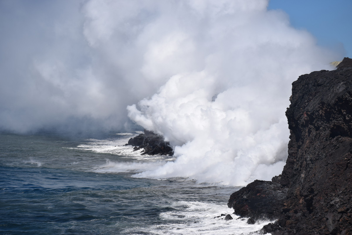
(BIVN) – Scientists have confirmed another delta collapse has occurred at the Kamokuna lava ocean entry along the cliffs of Hawaii Volcanoes National Park.
“On May 3, the front section of the Kamokuna lava delta collapsed into the sea,” the USGS Hawaiian Volcano Observatory wrote today, saying it is “a reminder that new land created by ocean entries is highly unstable and prone to collapse without warning.”
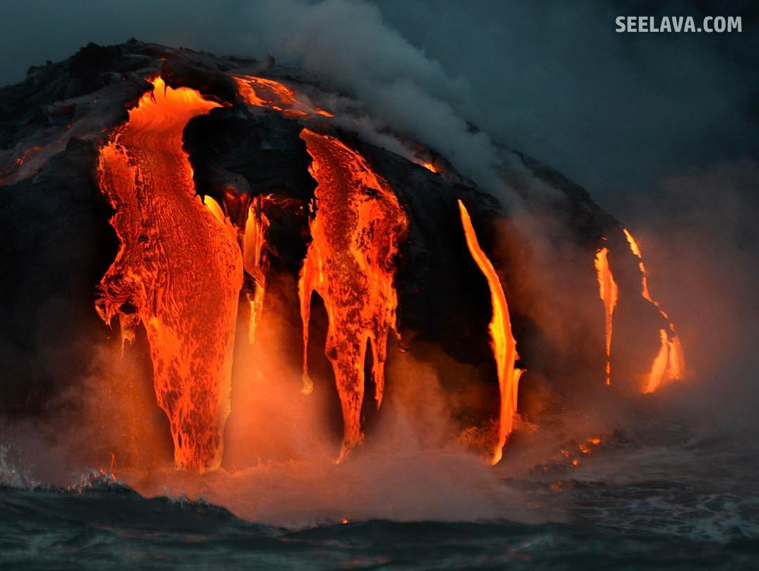
One of the first to report the delta collapse was Captain Shane Turpin aboard the Lava Ocean Tours boat. Turpin shared some before and after video, as well as some photos of the lava flow taken just before the collapse (see image above).
By land, John Tarson of Epic Lava Tours also reported seeing changes on the delta during recent trips to the ocean entry.
HVO scientists were out on the flow field today to observe the changes firsthand. UPDATE: USGS uploaded these photos captured by a time-lapse camera. The sequence of events was recorded in five-minute intervals.
(USGS) This image shows the lava delta at 7:50 a.m. HST, a couple of hours before the collapse.
(USGS) Between 9:35 and 9:40 a.m., a large steam plume appeared in the middle of Kamokuna lava delta in the area of large cracks noted in our April 27 image (see below). Weak fountaining or spattering likely occurred initially, because new tephra is visible in the steaming area, but that activity ended by 9:40 a.m. Images captured over the next 25 minutes show that the steam plume in the middle of the delta weakened, and the delta surface surrounding the steaming area subsided.
(USGS) Within five minutes, between 9:55 and 10:00 a.m. HST, nearly the entire delta disappeared, collapsing into the sea. The collapsed area cut back toward the sea cliff, past the largest crack on the delta. In this image, captured at 10:05 a.m., the seawater is brown and turbulent. Large blocks of steaming rocks are visible on top of a narrow slice of the remaining delta (center). These rocks were likely washed ashore by a small, localized tsunami generated by the collapse. During the next few hours, small pieces of the remnant delta continued to flake off and disappear into the ocean.
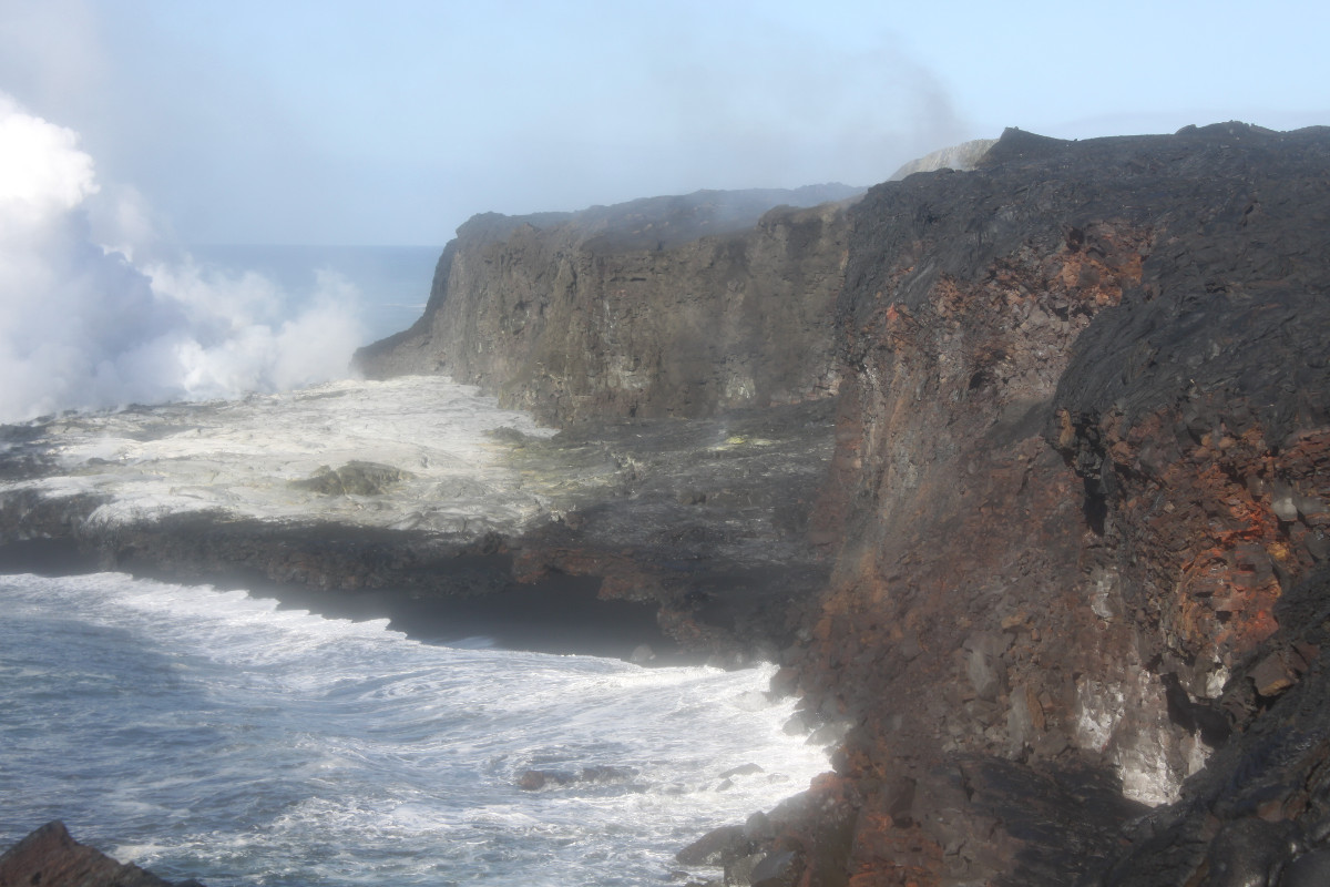
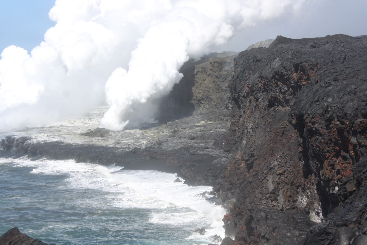
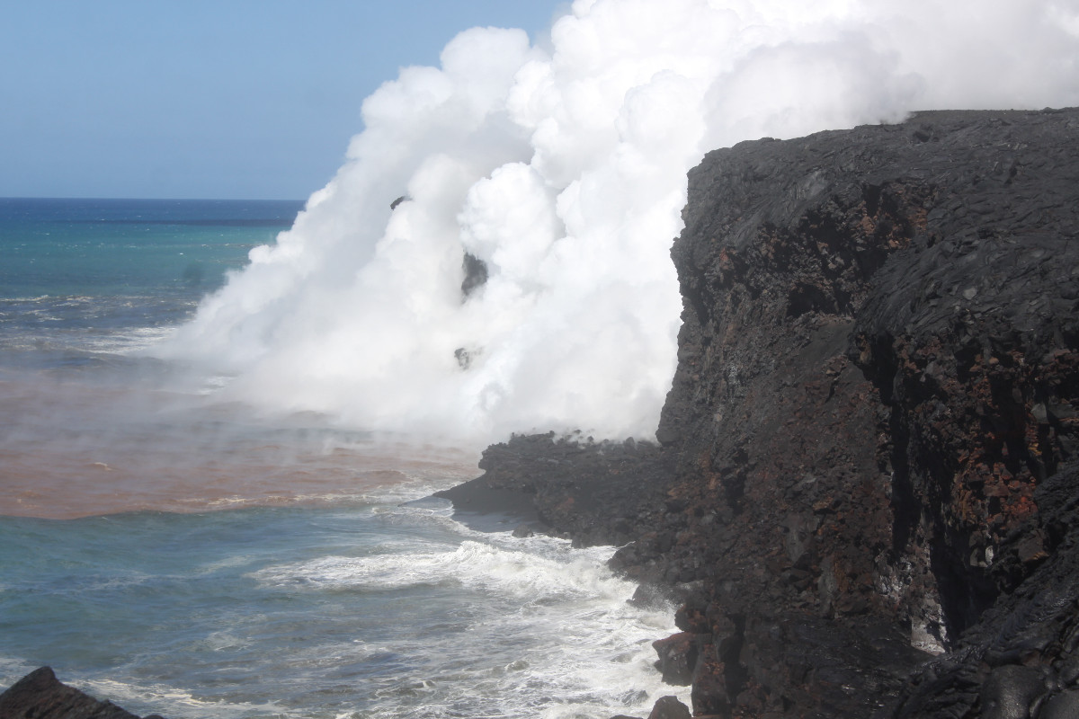
(USGS) This morning (May 4), the Kamokuna ocean entry was obscured by a thick steam plume at the base of the cliff. Sparse littoral bursts, occasionally visible through the plume, were the source of the floating, steaming lava fragments that can be seen in the ocean near the entry.
The episode 61g flow is still active, USGS says. The lava is entering the ocean, and was slowly building a lava delta at Kamokuna. The flows pose no threat to nearby communities at this time.
On May 3, the USGS produced this new map showing recent activity on the flow field.
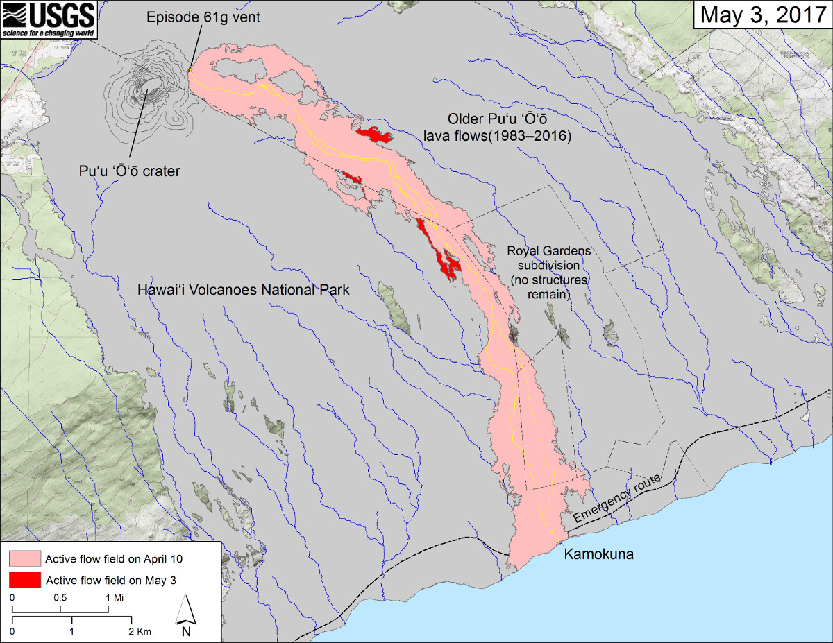
(USGS) This map shows recent changes to Kīlauea’s East Rift Zone lava flow field. The area of the active flow field as of April 10 is shown in pink, while widening and advancement of the active flow as of May 3 is shown in red. Older Puʻu ʻŌʻō lava flows (1983–2016) are shown in gray. The yellow line is the trace of the active lava tube (dashed where uncertain).

by Big Island Video News
on at
STORY SUMMARY
HAWAII VOLCANOES NATIONAL PARK - USGS scientists say the collapse is a reminder of the dangers present at the Kamokuna lava ocean entry.